In Outdoor Navigation with Augmented Reality and Spatial Anchor
Reading time: 3 min
Update: We won a Bronze Award of the Deutscher Digital Award for this project.
During my studies, it was often difficult to find the right rooms on campus. Be it still fresh in the first semester, because I was hopelessly lost or also during the main study, when lectures for example were moved at short notice from room “304” to room “520”. Logically, everyone would now become the 5th floor run and find the appropriate room. On this campus, however, finding space was at least as complicated as mathematical proofs. The reason: Room “304” was in building “2” on the 1st floor and room “520” was in building “11” on the 4th floor – easy, right?
It probably won’t be this complicated at every educational institution, but finding rooms, professors, or any kind of point of interest is usually part of students’ everyday campus life. And that can take time. Especially when you study on a large campus that covers almost 2 square kilometers.
So how about a nerve-friendly navigation solution?
It’s not like there are no navigation solutions for this scenario at all. But even the balancing act between indoor and outdoor navigation is often a major technological challenge. And exciting technologies such as Bluetooth using beacons, marker-based capabilities via image or QR code, or even magnetic sensing to solve the localization problem within rooms are unfortunately quickly driving up operating costs. And that’s where facility management or even the architect, with their already small budgets, are resisting.
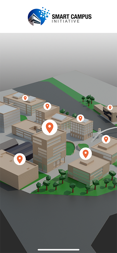
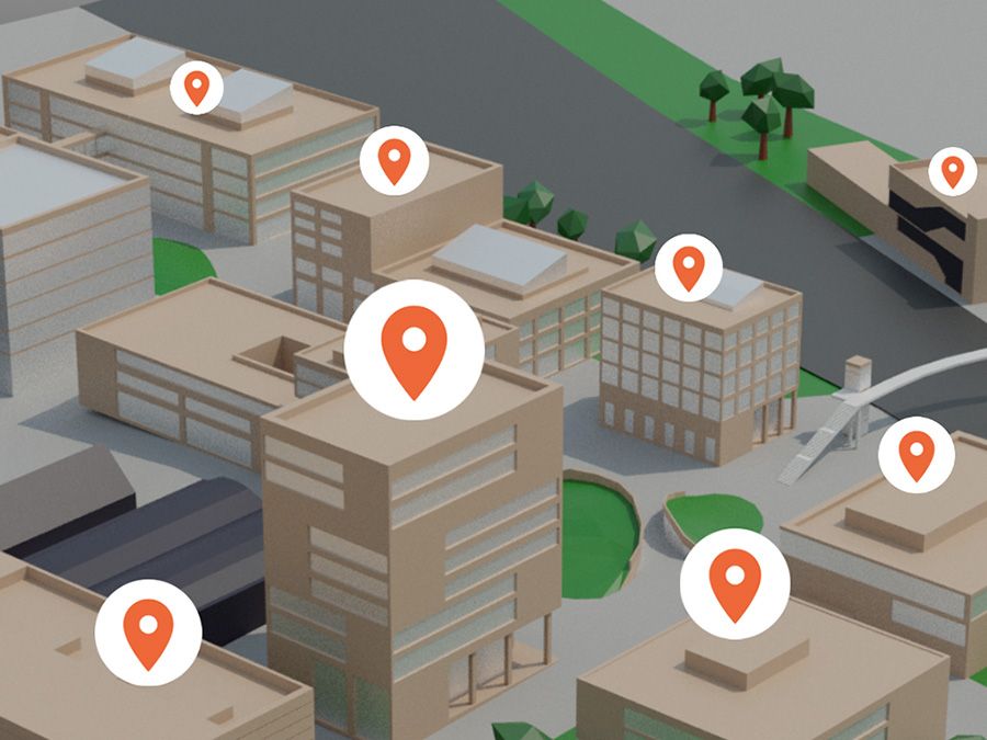
An exemplary overview screen on which various points of interest of the site are marked.We as mmmake have therefore commissioned the KODIS teams of the Fraunhofer IAO a navigation solution based on augmented reality and spatial anchors as a proof-of-concept (PoC) for Heilbronn’s Smart Campus Initiative which is completely “markerless” and does not require any additional sensors. All that is needed is: An ARCore or ARKit capable smartphone and an internet connection.
How can this work without “classic” navigation technologies?
Well, the full recipe would probably be too long for this post, but I can tell you the main ingredients that went into this novel navigation solution:
- ARKit (Apple)
- ARCore (Google)
- Azure Spatial Anchor (Microsoft)
- Unity3D and 3D models
- Artificial intelligence
What’s special here is the way we implemented localization using Spatial Anchor, AI, ARKit and ARCore, and especially the way we navigate using Unity3D.
Specifically, the solution provides a function to search points-of-interest (also called PINS) and start navigation to the selected PIN. The navigation is displayed in AR and always calculates the shortest route to the destination, starting from the current position. It doesn’t matter whether the user is inside a building or outdoors – transitions between outdoors and indoors are also seamless.
We have now also produced a beautifully designed four-minute computer for the project, take a look:
Campus is not the limit
The great thing about this system is that it’s not limited to campus use. It can easily be used in many other facilities, such as hospitals, shopping centers, airports, amusement parks or exhibition halls.
Our solution is new in its simplicity and relies only on a smartphone as hardware. So if you have a need for a lean and reliable navigation solution: Write us! Either to hello@mmmake.com or directly a personal message to me.
The author
Emre Bodur![]()